A note on the possible site of the Cooper family’s camp, and the history and layout of the Claremont estate. See also The Romany Family at Claremont.
Victoria’s diaries tell us that the Romany camp at Claremont in December 1836 was by the Portsmouth Road — a number of her diary entries describe how the Cooper family (who stopped there while a child was born) would cross the road to greet her. The princess passed by the tents on her regular walks with her governess, Louise Lehzen, and other house guests, and then painted portraits of the Cooper family from memory when she returned to Claremont House.
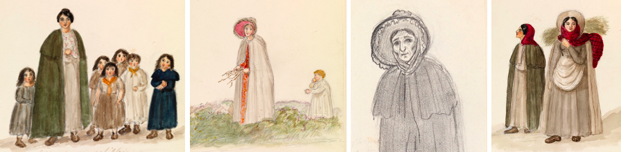
The Cooper family painted at Claremont by Princess Victoria: Sarah (with nieces and nephews), Philadelphia (with son Nelson), Mary, and Eliza (with Sarah)
Some of the walks lasted for up to two hours, and once or twice they drove past in a carriage rather than making it on foot (e.g. on Christmas Day in 1836, when it snowed). However, the diaries give no information about the route taken on the walks, and the place where the Cooper family put up their tents was not pinpointed accurately.
The eastern and southern boundary of the Claremont estate at the time of Victoria’s stay at the end of 1836 is drawn onto the map below as a dotted red line. The boundary to the west was the Portsmouth Road itself and, to the north, the estate stretched out towards Esher.
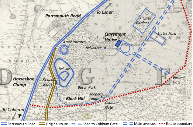
A map showing Claremont House, Horseshoe Clump and the Portsmouth Road
The background map reproduced here is the earliest detailed Ordnance Survey of the area (the six inches to the mile series of 1866-68). As it happens, the route of the Portsmouth Road past Claremont was altered over time, so it is worth delving briefly into the history that led to that change.
The house was built by the architect Sir John Vanbrugh on farmland that he had acquired outside Esher, and which he transformed into a country estate. Vanbrugh sold the property in 1714 to Thomas Pelham, who lived at Claremont for the next fifty five years. Pelham became the Duke of Newcastle, was twice prime minister, and added many more landscape features to Vanbrugh’s plans. Some are still there today, including the turf Amphitheatre, the Belvedere observatory, and Bel Isle in the reshaped lake.
When the estate was bought in 1769 by Robert Clive (Clive of India), he commissioned Capability Brown to design a completely new house. This has also survived and is now an imposing school building. Brown persuaded Clive to have the Portsmouth Road moved away from the lake and gardens by cutting through the slightly higher ground at Horseshoe Clump, on the edge of West End Common. When Claremont was purchased for Victoria’s uncle Leopold and his wife Charlotte (the daughter of George IV) on their marriage in 1816, the route taken by the Portsmouth Road was very much as it would have been twenty years later when Victoria met the Cooper family, and how it remains today — the Portsmouth Road is shown in dark blue on the above map, with the original route in dark brown.
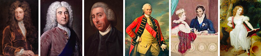
Claremont’s historical connections: John Vanbrugh, Thomas Pelham, Capability Brown, Robert Clive, Charlotte and Leopold, and the young and artistic Victoria
A survey prepared for Robert Clive (before Capability Brown proposed the road alterations) shows that a minor roadway skirted around Black Hill from the old Portsmouth Road to the Cobham Gate at the southerly end of Claremont’s main avenue. Vanbrugh designed two such avenues in front of Claremont House (the main entrance to the house faced away from the Portsmouth Road), and these are marked on the above map with double dashed lines. The roadway around Black Hill to the Cobham Gate is drawn with a single dashed line, the OS map showing that there was a keeper’s lodge at either end.
The older survey map is reproduced below, and has been annotated to indicate the Cobham Gate and the old Portsmouth Road.
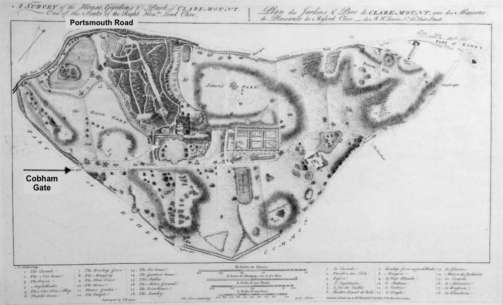
The Survey of Claremont prepared for Lord Clive
Victoria put more local detail into her diary entries when she visited Claremont in subsequent years, telling us (in 1840) how Albert drove her in a pony phaeton ”by the Park on to the Portsmouth Road and round by Cobham”, and (in 1842) that they went on “a long, rambling, exploring walk, going on the Portsmouth Road, over the Common.” Much later (in 1869) Victoria recorded that she “walked past the Keeper’s Lodge, through the wood close to the Portsmouth Road.” The references to the Park (presumably Blason Park), the Common and the Keeper’s Lodge all tie in with the places shown on the OS map.
However, as mentioned above, the diaries give little additional information about the route taken when Victoria encountered Mary Cooper and her family in 1836, except that Victoria and her companions seem to have kept to the roads while out walking and that they could see the camp not only across the Portsmouth Road when they passed by but also from a distance. A possible itinerary would have taken Victoria out of the main entrance at Claremont and along the main avenue to the estate boundary, with Blason Park to her right, and then past Black Hill towards the Portsmouth Road. A number of tracks criss-crossed this area according to the 1866 OS map, hence the Royal walking party could have made its way around the lake through Claremont grounds to the Portsmouth Road and perhaps have had sight then of the tents on the other side of the road.
This would place the camp in the vicinity of Horseshoe Clump, or along that same stretch of road where it was still Common land and where there was some shelter in the lee of the roadway and amongst the trees.
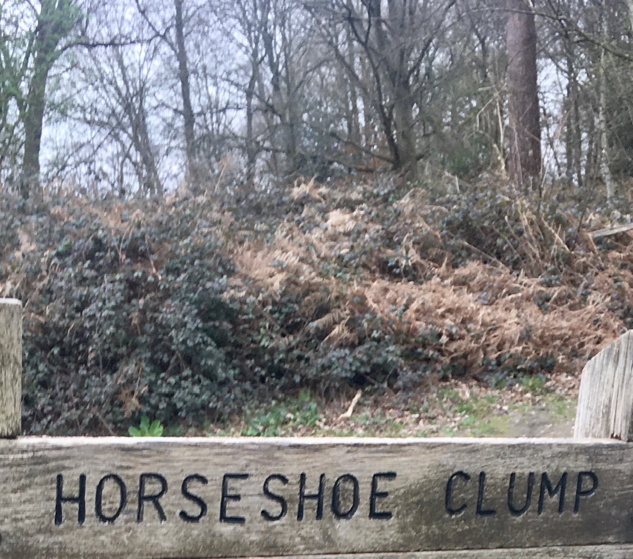
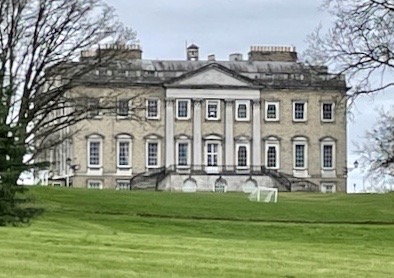
Recent photographs of the car park signpost at Horseshoe Clump looking towards West End Common (the car park is marked P on the map), and the present view of Claremont House from the Portsmouth Road.
AcknowledgmenTS
Thanks are due to the Royal Archive and the Royal Collection Trust regarding the reproduction here of the extracts from the diary transcripts and the copies of related paintings by Princess Victoria. These can be accessed directly at http://www.queenvictoriasjournals.org/ (the copyright holders are listed on the home page) and at https://www.rct.uk/ (all images from the Royal Collection Trust are the copyright of the Crown). The portraits of Sir John Vanbrugh, the Duke of Newcastle, Capability Brown, Lord Clive, Princess Charlotte, Prince Leopold and the young Victoria are in the public domain on Wikimedia. The Survey map prepared for Lord Clive, a plan of the gardens by John Rocque, is available on the Claremont Landscape Garden pages (click here), and is discussed in an unpublished dissertation for the Master of Landscape Architecture at Manchester Metropolitan University (The Evolutions and Revolutions of Claremont, by Sian Bury). I am grateful to the National Trust staff and volunteers at the Claremont Landscape Garden, who provided very helpful advice.

Leave a comment